
6:MG52Using scale on maps
Position (direction and coordinates) — Level 6
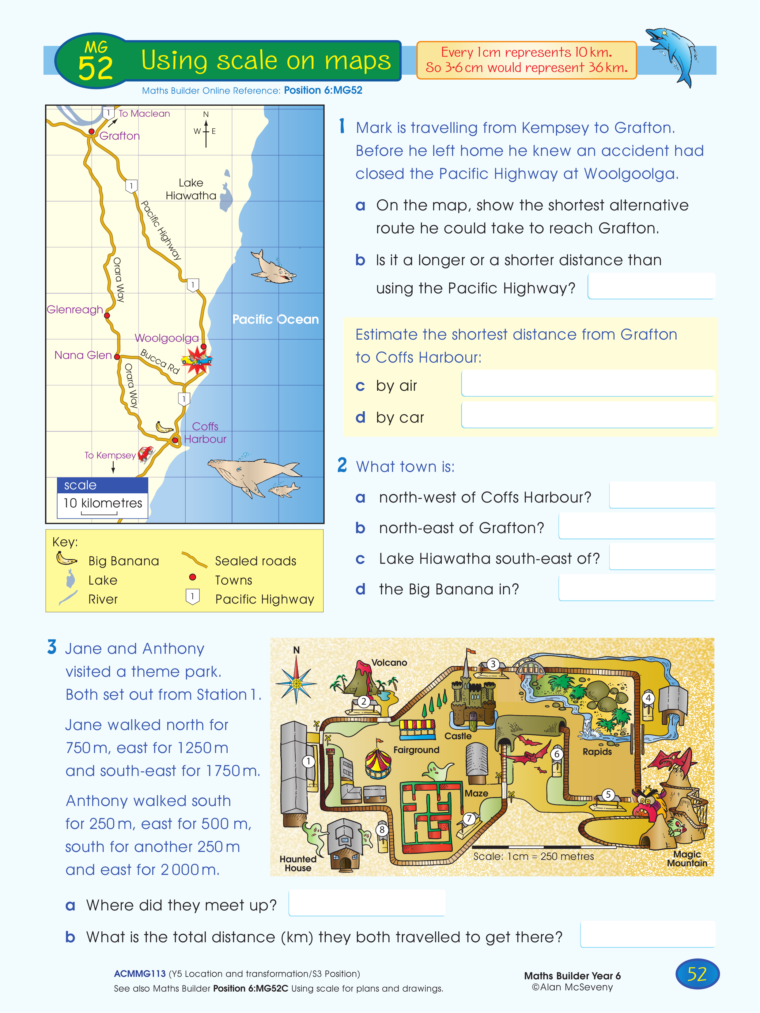
Using scale to determine distances and routes by air and by car. Locating places in given directions from towns and landmarks. Following complex compass directions to a final location. Calculating total distance.
Topics covered
- Measurement and Geometry › Location and transformation › Using a grid reference system to describe location


